A hidden Dorset delight and a cave!
- David Hill

- Sep 14, 2025
- 8 min read
Updated: Sep 16, 2025
Sat 13 Sep ‘25. DH, RW, PCl, DL, JB, CM & Scrumpy
When you have lived in an area for as long as most of us have, you tend to think that you will have seen most places within a fifteen mile radius, but today was a first for all of us as we ventured into a hidden part of North Dorset, only a couple of miles from both Yeovil and Sherborne. Tucked away just north of the A30 are the villages of Over Compton and Nether Compton which are not on any route normally taken home when leaving the bright lights of Yeovil. It’s an area that has been on my list for a while now and so following a wet week but with with good weather forecast until at least 11 o’clock, I decided that today was the day to give it a go.
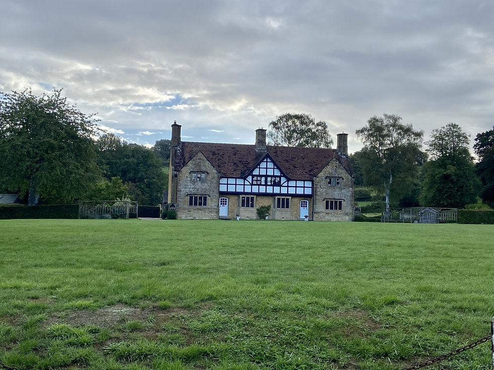
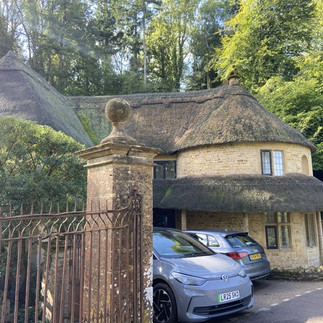
We approached the larger village of Nether Compton heading south along the edge of another rarely visited village of Trent and arrived at the RV by the very impressive village green in front on a large half Tudor cottage, with the village church at the far end. The peace of the village morning was soon shattered when with the Wincanton and Cary cars parked twenty metres apart, there were morning greetings shouted up and down to each other. We we really delighted to see Chris emerge from the back of Richards car, the first time back with us for quite a few months.
Once we had all taken in the stunning village scene we managed to get going about ten minutes later than planned. Heading north up the Main Street we passed numerous quant cottages made from local ham type stone. At the end of the street a rather plain looking pub, the Griffins Head, occupied the outside bend as we turned left onto a small lane heading in a north west direction, as the route I initially planned would have taken us through agricultural land likely to be pretty damp. The track was muddy and slippery from the recent rain and we made our way through or around some of the first puddles we have come across for quite a few months. Along the left side of the track, Trent brook was flowing towards the River Yeo and we paused for a few seconds to take in the noise of the countryside and the moving water as it babbled over a few rocks and down a small drop in the stream bed. At the end of the lane, by the well hidden Mill Cottage we turned right along a minor road into the eastern edges of Trent village. The village of Trent is well known as being the resting and hiding place of King Charles II as he fled following his defeat by Oliver Cromwell at Worcester in 1651.
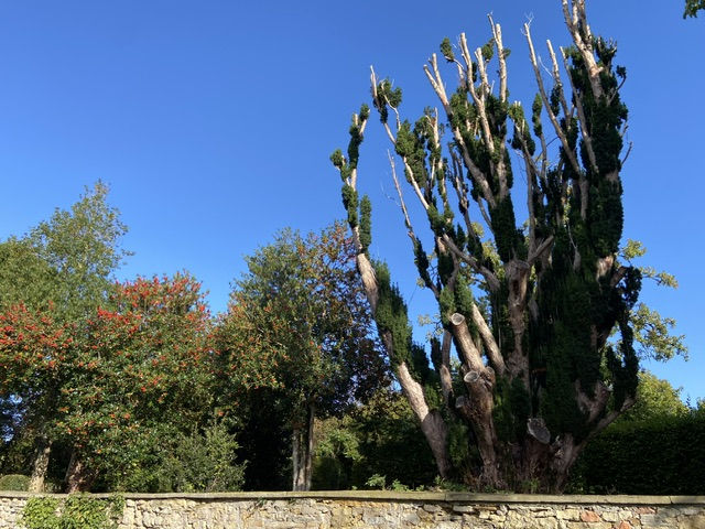
There were some substantial properties along the roadside mainly behind large walls but poking over the top we could see many mature trees against the bright blue sky. A rather strangely pruned yew looked very bare whilst a large Holly bush had enough berries on it to keep all the local birds happy. Although I didn’t see it, as we continued along there were cries of delight at the sight of a walnut tree, and even more pleasure when a couple fallen nuts were cracked open and readily consumed.

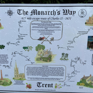


At the very end of the village to the side of Down Lane we came across a small pond with a nice bench behind it and alongside was a large board with images and information all about Charles IIs route around the area and the creation of the Monarchs Way, a Long distance path following the approximate route on which the King made his escape. We continued east along the lane and this section of the Monarchs Way and with plenty of signs about local wildlife, Richard kept Scrumpy on her lead, or she would have been off chasing the many pheasants we came across.
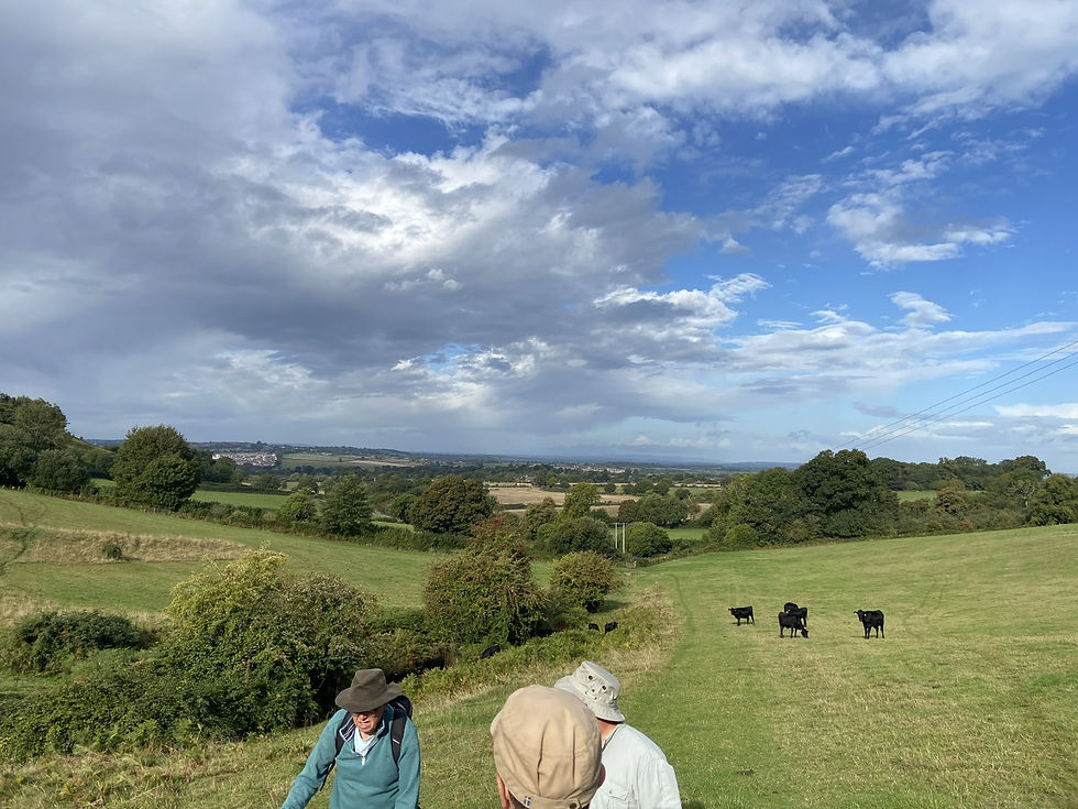
As the track turned to the right we passed through a gate and into a field with a few young black cattle in it. They soon moved off of our path which was a steady climb up alongside a stream. Chris powered on up the hill whilst some of us stopped more often to appreciate the view behind us across to the west and the edges of Yeovil. At the top of the reentrant we passed through a wooded section and then along to join Checombe Lane, the muddy track north of Sherborne along which we walked back in February of this year. A perfect place to stop for the issuing of this weekly lollies.
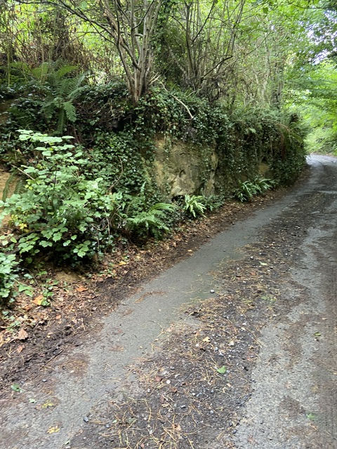
Turning right we again had to skirt around a few large puddles as we headed south. The views on top of the ridge opened up through a full 180 degrees in front of us with the woods above Sherborne to our left and the rooftops of north east Yeovil to our right. As we started to drop down we took at right fork onto Rayleigh Lane which dropped down past a chicken farm, easily identified by the smell, and into an area described on other walking sites as a Holloway.
There was much discussion about how they were formed, as there are similar roads and tracks around much of Yeovil. I’m no expert but the following explanation was found on a Sherborne walking group website.
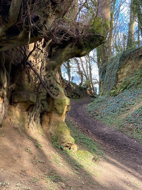
Situated in North West Dorset, and beside the A30 a network of paths exist as the oolitic limestone reaches its inevitable edge. Steep sided Holloways exist because the geology is soft and the change in altitude steep. They have been carved over time by carts to create steep sided, dark, damp clefts with a unique flora. Water can modify them later but tends to create a different cross profile. Once the underlying bedrock is reached they tend to reach a dynamic equilibrium. A useful article here about the oolitic limestone in the south of England.
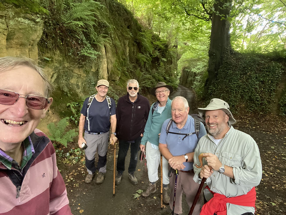
However they were caused, (and it looked to me like there were signs of drilling in some of the banks, possibly when it was widened to be made into a tarmac road), it certainly made an unusual place for this weeks group photo. We continued down and with the noise of the passing traffic on the A30 increasing with every step, we made it into the hamlet of Stallen. There were more lovely local stone cottages and behind some impressive gates stood the attractive Stallen Manor. We walked down the road to the bend and then headed left up Smelland’s Lane, another Holloway.
When first deciding on this route I had used the megalithic.co.uk website as usual and was very surprised to see a cave marked in the area. As we dropped down a short slope we could see the metal gate at the front of a stone hole in the limestone bank, which was obviously the cave we were looking for. Like biblical animals going onto the ark, we went in two by two to take a better look. It only goes back a few feet with a small side room and apart from a big spider guarding its clutch of eggs in its nest hanging from the roof, it was there wsas nothing much to explain it’s previous usage. As luck would have it, a lady walking round the area with her white scotty dog asked if we had just been in the potato cave. She then went on to explain there was also another unrestored cave further down and explained the story,which I have copied below from another website.
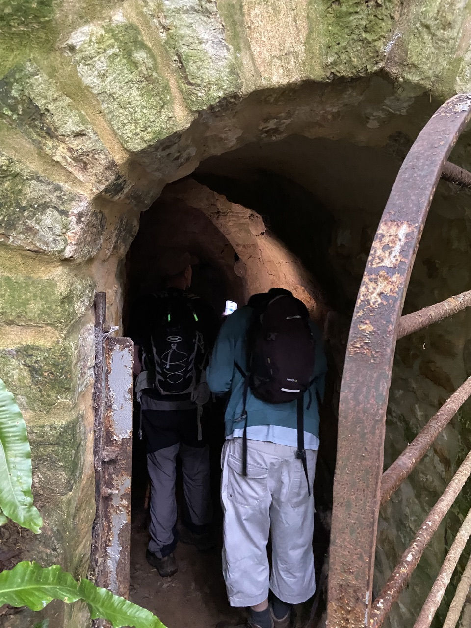
The caves date back to Elizabethan and Jacobean times and have been there since the time of the first introduction of the potato to the British Isles. They were dug as potato stores.The tubers of white potatoes grown by the Incas were tasted by Sir Francis Drake in 1577 during his circumnavigation of the globe. In 1586 Drake took possession of some potatoes that were being carried as ships stores. They found their way via traders commissioned by Sir Walter Raleigh to England. Due to the Raleigh connection when he was living at Sherborne Castle the crop was first grown on the light soils to the west of Sherborne. After being dug the potatoes have to be stored in cool dark conditions to stop them going green and poisonous. This was initially a problem for the English growers but they solved it by digging a series of caves into the sandstone banks of the ancient holloways of this area. They were known as Tiddy Caves.
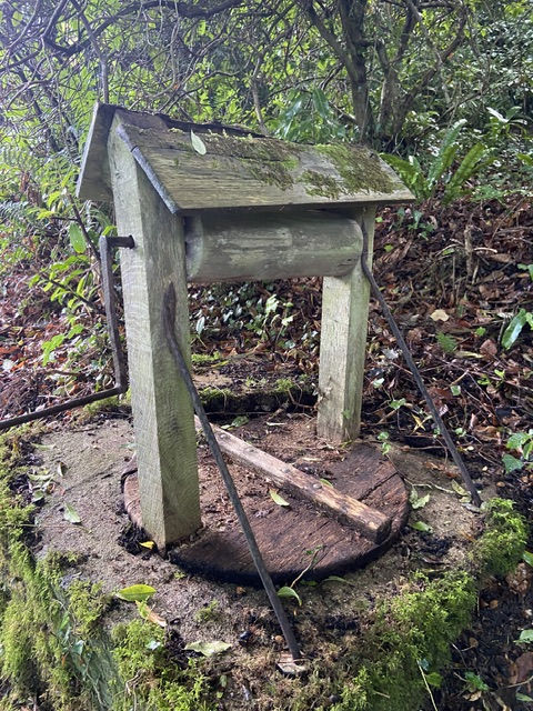
It turns out that the lady used to live opposite Sexey’s school in Bruton and her husband taught at Ansford school for over thirty years. She advised us not to take the lower track as it was very wet so we stayed higher and pushed on through the lovely wood, with sweet and horse chestnut trees heavily laden. Just before the end of the track a property on the right was tucked away in the woods and had a dilapidated well at the side of the drive. I’m guessing that as the house is on the market for just shy of one million pounds, it’s not their current water source! As time was no running short before we had to get to our breakfast booking, I decided to leave out the section of the walk which would have taken us by Compton House and instead we turned right down a narrow lane along which we could just about see bits of the house and lake through the trees and bushes on our left. At the end of the lane a large set of gates stood next to the former gate cottage which has been very nicely updated and extended.


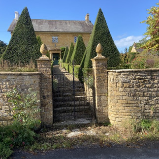
We came out onto the main road by the one hundred year old Sheriffs cottage and opposite the village hall. Further down we past the old school rooms and just before the church another stunning property stood at the end of some well manicured topiary trees.

As we approached the Grade 1 listed parish church of St Nicholas. St Nicholas' Church has a 13th century nave and chancel and is made from local Ham stone. Unusually it has a late 15th century asymmetrical stone rood screen. The tower, of the same era, houses a ring of six bells that are rung from ground level. This means that the ropes are much longer than the average and can cause difficulties to visiting ringers. On the south side of the tower is a sundial instead of a usual addition of an analogue clock seen on most churches. On the walls either side of the entrance are also three scratch dials of varying degrees of accuracy. It appears that they didn’t want anyone late for services!

We arrived back at the cars having completed 4.75 miles in just over two hours. Initially I was hoping we would have breakfast at the Brittania Inn in Sherborne, but on trying to book I was informed they are not serving breakfasts currently, so I had reserved us a table at the Farmyard Kitchen on the A30 at the eastern side of town for 11 o’clock.
We arrived fractionally after the time but were shown to our large table by the picture window and given menus. The last time we came here it was operating as The Toy Barn, but has since been taken over by Hunts Foods, so we were hopeful of a better experience than previously. When our food was delivered a few minutes later, it was clear that things had improved a beyond recognition.
I think all of us agreed that it was a fitting end to a really good walk of discovery which certainly ranks up there as one of our best ever. I for one am certainly looking forward to returning to the area in a few months time when we can explore more of the Holloways and the village of Over Compton as well.
Acknowledgments:
Comments